Decades before the Interstate Highway System reshaped travel, commerce, and communities, the first intercontinental highway emerged in pre-World War I America. The oldest, longest, and highest of these transcontinental routes is U.S. Route 6.
Midway between the highway’s coastal endpoints in California and Massachusetts, Route 6 defined many of Omaha’s most important traffic corridors. The route—known by different names depending on the era, locale, and new construction—was dedicated to American Civil War veterans, and it carries the title “Grand Army of the Republic Highway.” Today, the highway stretches (sometimes erratically) 3,652 miles from Long Beach to Provincetown across 14 states.
The story of Route 6 in Omaha is part of the story of Omaha itself. And Roger Bratt wants to tell you all about it.
r r
r
Bratt, a resident of Lousiville, Nebraska, has turned his passion for history into a passion for telling the story of Route 6. He is vice president of the U.S. Route 6 Tourist Association and interim executive director of the association’s Nebraska operations. The group holds events to rekindle interest in the route’s history and drive tourism and economic development for towns along its path.
“When I traveled all over the country for work, I’d take these old [Route 6] stretches to explore,” the retired Bratt explains. “I have driven on almost every mile of Route 6—not all at once, but in bits and pieces. I found it interesting because I used to ride it. This was a connection back to Nebraska for me.”
As a young boy in the ’50s, Bratt would ride shotgun with his father, Peter, who ran a small trucking business out of Bennett, near Lincoln.
“I was a little kid at the time, so I would get my homework done and ride along with Dad,” Bratt recalls. “I loved that!”
Peter and his drivers would pick up livestock from area farmers and head up Route 6 through Ashland and Gretna, hooking up to Q Street at 84th and then eastward on L Street to the stockyards. After delivering the cattle, drivers would head to the truck washes behind Johnny’s Café, which stayed open until 1 in the morning so drivers and stockyard workers could eat breakfast, lunch, or dinner.
Then it was off to nearby Sutherland Lumber, where Roger would sleep in his father’s cab until lumberyard workers banged on the door, their signal the truck had been loaded with deliveries for customers along Route 6 on their way home.
Today, Omahans think of a highway named 6 as Dodge Street—but that came half a century later. The original Route 6 dates back to 1911.
From east to west, the original path of Route 6 entered the Omaha area from the southwest, going from 144th Street to Millard Avenue to 132nd and then onto Center Street (then known as Lincoln Avenue), passing cultural icons such as Aksarben and Petrow’s Restaurant before wrapping around Hanscom Park along Park Avenue up to Farnam Street past the Colonial and Blackstone hotels. Another jog onto Douglas Street saw Route 6 head into Iowa over the bridge built for the electric railcars that stretched the length of Broadway in Council Bluffs.
In the 1930s, the Works Progress Administration built the Saddle Creek Underpass, and the path of Route 6 shifted onto Saddle Creek Road (named after the former creek buried underneath) before connecting with Farnam Street.
Referring to the historic Route 6 today can be confusing to many Omaha residents because Dodge Street is currently the official Route 6. Bratt says it was rerouted to Dodge Street in the early 1960s after the demolition of the Aksarben Bridge and construction of Interstate 480. Further complicating the naming rights, Dodge Street was also the Lincoln Highway and other numbered highways in its lifetime.
The former path of Route 6 has mostly vanished under modern streets. But a rare brick portion of the old highway remains within Omaha city limits. Bratt says residents south of 96th and Center streets worked with the City of Omaha to preserve a four-block section of the highway’s brick pavers in the mid-20th century.
This vestigial section is called Frontage Road and runs parallel to Center Street from Oakdale Elementary School. “I was scared to death when I saw it all torn up when they were renovating the school,” Bratt says. “But [the remaining road] looks beautiful now.”
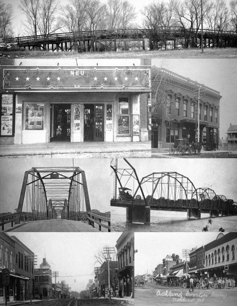
In Nebraska, the original dirt highway sprung up in noncontiguous locations—in western Nebraska in 1911, in the Ashland area during the same period, and in Lincoln (today’s Cornhusker Highway) in the ’20s. Route 6 wasn’t known as Route 6 until the 1930s, often referred to as the OLD Highway (Omaha-Lincoln-Denver) in its early days.
r r
r
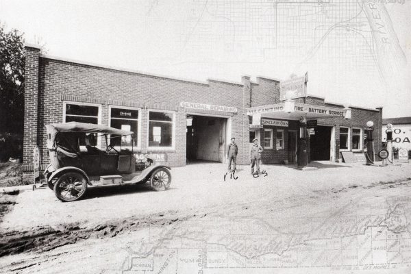
In his personal collection of Route 6 photos and maps, Bratt keeps some photographic gems from Ashland. There’s an image of a 1911 or 1912 parade promoting the new route between Omaha and Denver (and promoting automobiles alongside horses and buggies), and another photo of men and their cars outside Ashland on one of the “cruises” that sprouted with the route. Along the highway is a signpost: “OLD—The Best Dirt Road in the U.S.”
Today, the association works to preserve this heritage while promoting tourism and attracting new residents to small towns along the highway. Bratt is fond of his work in Nebraska, where Route 6 continues to course through southern Nebraska from Lincoln into small towns (including Friend, Hastings, Minden, McCook, etc.) and onward into Colorado.
Bratt has traveled to make presentations in these towns and works with association members—many from abroad—who want to drive the route and explore communities and countryside along the way. Some tourists, Bratt says, express interest in moving to their favorite towns.
“They are interested in the old routes because the transcontinental route was what built America,” Bratt says.
r
Visit route6tour.com for more information.
rThis article first appeared in the May 2019 edition of 60PLUS in Omaha Magazine. To receive the magazine, click here to subscribe.


